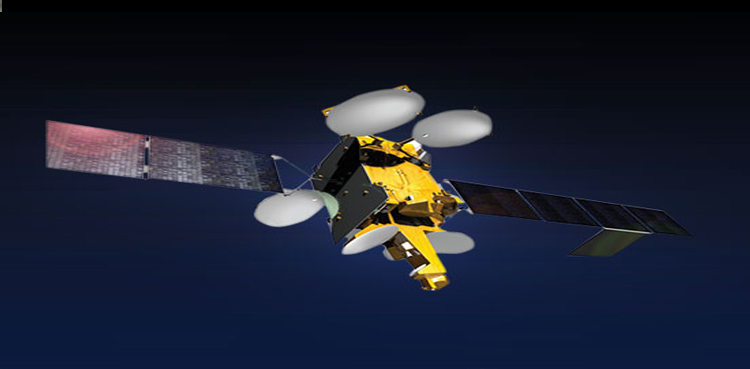
ISLAMABAD: The Pakistan Space and Upper Atmosphere Research Commission (SUPARCO) has announced the upcoming launch of Pakistan’s Remote Sensing Satellite (PRSS) for geospatial mapping of key national initiatives, including the China-Pakistan Economic Corridor (CPEC).
The satellite, set to be launched from the Xichang Satellite Launch Center (XSLC) in China on July 31, 2025, marks a major step forward in Pakistan’s space program, significantly enhancing the country’s Earth observation and imaging capabilities.
Equipped with advanced, state-of-the-art imaging systems, the new satellite will support a wide range of national applications — from precision agriculture and urban planning to environmental monitoring and disaster management.
The satellite’s advanced sensors will play a vital role in predicting and mitigating the impacts of floods, earthquakes, landslides, glacier melt, and deforestation, enabling data-driven decision-making in resource management. It will also contribute to infrastructure planning and geospatial mapping under key national initiatives, including the China-Pakistan Economic Corridor (CPEC).
With its addition to Pakistan’s growing space fleet — which already includes PRSS-1 (launched in 2018) and the Electro-Optical Satellite EO-1 (launched in January 2025) — the new PRSS satellite further strengthens SUPARCO’s capabilities and aligns with the National Space Policy and Vision 2047, aimed at transforming Pakistan into a technologically advanced, spacefaring nation.
A Decade of Space Progress
Pakistan’s modern space era was revitalized in 2011 with the launch of PakSat-1R, a communications satellite developed with Chinese collaboration. This momentum continued with the launch of PakTES-1A and PRSS-1 in 2018, reinforcing a strong strategic partnership with China in space science and technology.
In 2024, the launch of PakSat-MM1 brought high-speed internet to underserved areas, while iCube-Qamar, a student-built satellite developed by the Institute of Space Technology (IST), made headlines by capturing stunning images of the Moon — a moment of pride for Pakistan’s emerging generation of scientists and engineers.
Most notably, in January 2025, Pakistan achieved a major milestone by launching its first indigenously developed satellite — EO-1 — designed entirely by Pakistani scientists and engineers. EO-1 was built for precision agriculture, disaster monitoring, and environmental analysis, marking a new era of technological self-reliance.
Now, with the upcoming launch of its latest remote sensing satellite, Pakistan reaffirms its commitment to harnessing space technology for national development, disaster resilience, and global scientific recognition — a proud chapter in the country’s journey from aspiration to achievement.
from Science and Technology News - Latest science and technology news https://ift.tt/lSwFiMo


